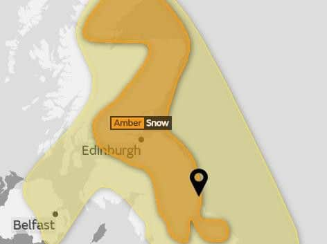
Amber warning for snow tomorrow across North East as Beast from the East stays put


The weather system that has brought snow and ice to the region is set to stay until the end of the working week.
The Met Office has extended its weather warning until Saturday.
Advertisement
Hide AdAdvertisement
Hide AdAn amber warning for snow is in place throughout tomorrow and Thursday, with an added risk of ice on Thursday night, with yellow warnings for snow in place on Friday and Saturday.
The Met Office detailed forecast says: "Snow showers will bring variable snow cover, but parts of northeast England and Scotland are expected to see the most frequent snow showers from Wednesday morning to Thursday afternoon.
"During this time, 5-10 cm of snow is expected quite widely. Where showers become organised though, most likely across Scotland and over the hills of northern England, some places are likely to have an additional 15-25 cm of snow, locally as much as 40 cm.
"Strong winds will lead to drifting of snow and severe wind chill, while lightning could be an additional hazard, particularly near coasts.
Advertisement
Hide AdAdvertisement
Hide Ad"This warning has been updated to extend the area south across parts of northern England, this particularly for Wednesday and the first part of Thursday, whilst the end time has been extended to later on Thursday."
By Friday, things should ease a little: "Frequent snow showers are likely to continue feeding in from the North Sea on a very cold easterly wind.
"Due to the nature of showers, some places are expected to receive an additional 5-10 cm of snow per day, whereas other places nearby may only receive small amounts.
"Brisk winds will lead to some drifting of snow, as well as a severe wind chill, although these are expected to begin to ease through Friday."