Christmas travellers told to expect delays as Met Office issues latest December weather warning for snow and ice in the North East and the rest of the UK
and live on Freeview channel 276
The region has already endured one prolonged alert period, which saw temperatures plummet this week.
Families enduring the freezing conditions had been looking forward to the prospect of some milder weather next week, when mercury readings are expected to reach double figures.
Advertisement
Hide AdAdvertisement
Hide AdBut the latest cold snap is due for a second wind before that, with a yellow weather warning for snow and ice issued by the Met Office covering the whole of the North East and due to last most of Sunday (December 18).
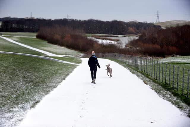


According to forecasters: “A period of snow will lead to some disruption to travel and other activities, before turning to rain later.”
When is the weather warning in place and which areas does it affect?
The Met Office has issued two alerts for Sunday, covering most of the UK.
A yellow alert for snow and ice will be in force from 7am – 9pm on Sunday, covering most of Scotland and most of Northern England, including the whole of the North East.
Advertisement
Hide AdAdvertisement
Hide AdA separate alert for ice has also been announced, covering most of Wales, the Midlands and Southern England, from 3am – 2pm on Sunday.
What should the North East expect during the weather warning period?
The Met Office has told households and travellers to expect:
*Delays on roads which could leave some vehicles and passengers stranded
*Delayed or cancelled rail and air travel
*Some rural communities could become cut off
*Power cuts, which may also affect other services, such as mobile phone coverage
Advertisement
Hide AdAdvertisement
Hide Ad*The possibility of injuries from slips and falls on icy surfaces
How does the forecast look after the end of the weather warning period?
According to the Met Office, Sunday’s cold snap is expected to herald a rise in temperatures, bringing milder, wetter and windier weather with it.
However, forecasters have warned this could be just a “temporary reprieve” from the arctic blast which struck the North East this week, with conditions set to turn chillier in time for Christmas Day.
Met Office deputy chief forecaster, Helen Caughey, said: “The northerly airflow and cold conditions which have dominated our weather patterns over the last 10 days will start to lose ground to a push of mild air from the southwest on Sunday.
Advertisement
Hide AdAdvertisement
Hide Ad“As the mild air meets the cold air currently in situ over the UK there will be a transient spell of snow, potentially to low levels, especially in the north.
"Add to this the risk of rain falling onto frozen surfaces, and strong winds over upland areas of northern Britain, bringing blizzard conditions, and this could be a day to avoid travelling in some areas, although the snow should turn to rain later.”
She added: “The unsettled picture for next week means, that although Christmas is just a week away, it is still not possible to say with any certainty if we will have a white Christmas Day or not.”
Should I be doing anything to prepare for more cold weather?
Met Office guidance suggests household should check insulation on water pipes to avoid pipe-bursts during freeze-thaw conditions.
National Highways recommends keeping “essential items like a torch and warm clothes” in cars during winter.