Weather warning for ice as Met Office urges care as snow refreezes with yet more showers on the way
and live on Freeview channel 276
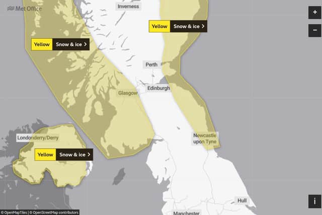
The yellow alert for snow and ice has been extended once again, taking the region and the east coast of Scotland from noon tomorrow, Friday, February 12, into Saturday, February 13.
It says further snowfall could bring travel disruption and warns some roads and rail networks are likely to be affected with longer journey times.

Advertisement
Hide AdAdvertisement
Hide AdThere is also a chance of icy patches on some untreated roads and paths.
Further falls of between 1cm to 3cm are expected, with the team sharing a photo taken by a satellite from space, showing where snow can already be seen across the UK.
In its warning, it added: “In addition, icy stretches will form as any partially melted snow refreezes, especially at lower levels.”
The forecast for the region for tomorrow sets out it will remain “very cold” with strengthening southeasterly winds, with cloud spreading inland during the afternoon.

Advertisement
Hide AdAdvertisement
Hide AdThe Northumberland coastline is most likely to see snow showers at this stage, with the temperature to hit its warmest at 2C and -1C at its coldest, but the conditions could make it feel as if it is -8C at some times.
From Saturday and into Monday, it will be windy and dry but increasingly cloudy on Saturday.
There will be a risk of snow or freezing rain spreading eastwards on Sunday and then it will be cloudy and wet but milder on Monday.