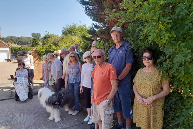
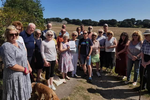
Campaigners rally against Local Plan after farmland in Cleadon earmarked for 156 homes
and live on Freeview channel 276
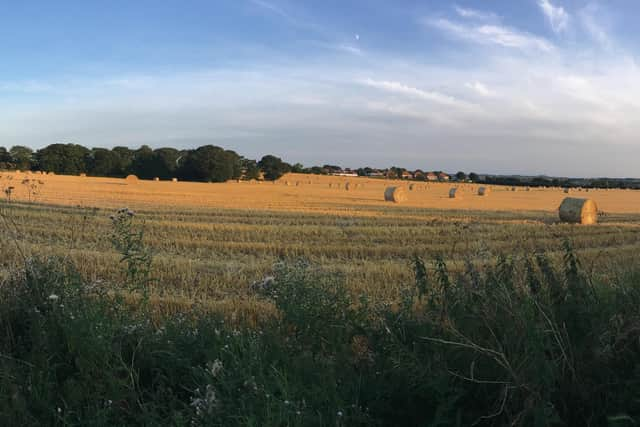
The land near Cleadon Hills, about the size of 10 football pitches, is one of a number of plots allocated for housing under South Tyneside Council’s Local Plan.
But people living nearby residents say such development would be disastrous for the area.
Advertisement
Hide AdAdvertisement
Hide AdOpponents say the council has decided half the field – behind The New Ship pub in Sunderland Road – is level two (“Very Good Quality Agricultural Land”) and the other half level three, (“Good to Moderate Quality Land”) which means building could be allowed on the latter half.

Their objections include concerns over air quality, urban sprawl, light pollution, increased traffic, noise, ecology, biodiversity, the removal of an ancient boundary between Cleadon and South Shields and closeness to the Cleadon Hills Local Nature Reserve.
The land is farmed for wheat which, which objectors point out is in short supply globally since the Russian invasion of Ukraine.
The development would also be very close to the 7th century Bede’s way, an historic trail and visitor attraction.
Advertisement
Hide AdAdvertisement
Hide AdThe land is owned by the Church of England. In 2021 a housing commission set up by the Archbishop of Canterbury said thousands of hectares owned by the church could be used to build affordable homes.
Campaigner and local resident Jane Mills said: “This area, including the proposed site, is unique in the borough.
“The site is part of a much larger, high yield arable food producing field. It borders (the current boundary for greenbelt) a historic footpath first documented in the 7th century. It links two ancient monasteries; St Paul’s in Jarrow and St Peter’s in Monkwearmouth.
“There is no other path with this history in South Tyneside. South Tyneside Council acknowledged this and named the path Bede’s Way.”
Advertisement
Hide AdAdvertisement
Hide AdVarious objections have been made to the Local Plan, including in Boldon Colliery where campaigners staged a day of action earlier this week over concerns green space known as Disco Fields was earmarked for housing.
Members of the East Boldon Forum say the present Local Plan would see 3,000 houses potentially built on green belt land, including areas in and around the villages of Whitburn, Cleadon, East Boldon and Fellgate.
However, Cllr Margaret Meling, lead member for Economic Growth, Skills and Climate Change at South Tyneside Council, stressed no decisions have yet been made.
Advertisement
Hide AdAdvertisement
Hide AdThe local authority has been encouraging residents to take part in a consultation on the Local Plan.
Cllr Melling said: “Residents have until this Sunday (Aug 14) to give their views within the public consultation period.

“Nothing is set in stone; officers will analyse responses to help shape the next phase of the plan, and ultimately, the plan will be submitted to the Secretary of State for a public examination before an independent planning inspector.
“To be formally considered, views must be made in writing via the appropriate channels. For further information, visit www.southtyneside.gov.uk/localplan.”