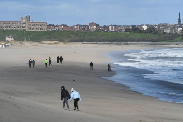
Temperature drop and 18ft waves are predicted for South Shields coastline in coming days
and live on Freeview channel 276
Areas of the North East woke today, Monday, April 5, to a sprinkling of sleet, with further cold weather on its way.
It comes as waves as high as 13ft are expected to hit our coast today, while they will rise to 18ft tomorrow afternoon, Tuesday, April 6, and then as high as 16ft during Wednesday morning, April 7.
Advertisement
Hide AdAdvertisement
Hide AdIf you’re heading out, this is what the Met Office says we can expect.

What is predicted for later today?
Forecasters say we could see some more snow showers develop during the afternoon, with these more likely along the coastal areas of the region.
The warmest it will get is 6C around mid-afternoon, but the windy conditions will mean it will feel as cold as -3C this evening.
During the night, we can expect a dry and clear night, although it is still possible we will see more snow showers.
Advertisement
Hide AdAdvertisement
Hide AdThe winds will remain strong and we could see a widespread frost in the evening.
What can we expect tomorrow?
On Tuesday it will be another cold day, with sunny spells but a greater chance of snow showers.
The winds will remain strong and again, we’ll see a widespread frost overnight.
The maximum temperature will be 4C around early afternoon, but it will feel as cold as -2C during the mid-morning time.
How about the longer outlook?
Advertisement
Hide AdAdvertisement
Hide AdFrom Wednesday to Friday, April 9, the Met Office says it will be less cold and windy on Wednesday but cloudier, with some rain overnight.
It will be windy and somewhat milder on Thursday, with rain at times and then colder again on Friday, with further wintry showers.
Will the cold weather continue?
The outlook for Friday to Sunday, April 18, suggests it will be a period of less cold and more settled conditions which will once again give way to another very cold and wintry picture, especially for northern areas.
Within this a mixture of sunny spells and showers remains likely and some outbreaks may be wintry, especially in the north, with strong winds expected.
Advertisement
Hide AdAdvertisement
Hide AdAfter this, conditions are likely be drier and more settled for most.